Clinton County Historical Association
Heritage Corner discusses the 1813 New York Gazetter
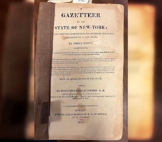
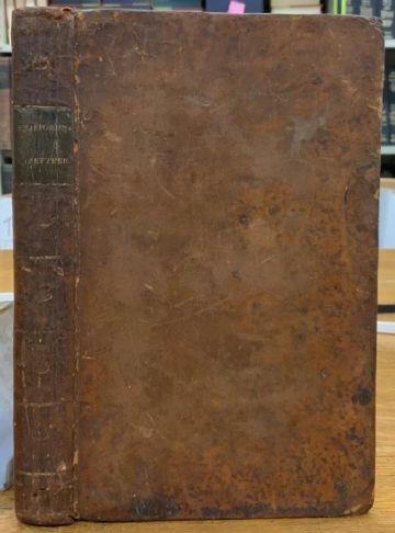
Tucked away in the Clinton County Historical Association (CCHA) archives is the 1813 New York Gazetteer with over 340 pages covering the geology, statistics and descriptions of New York counties and towns as seen in 1813. The book at CCHA was originally owned by Asa Adgate, the first Town Clerk of ‘Old’ Peru and handed down through his family, eventually landing at CCHA in 1961. Content for the Gazetteer was assembled by Horatio Gates Spafford, a fifth-generation American and son of Col. John Spofford. According to the Sons of the American Revolution records, Col John was with Ethan Allen and Benedict Arnold at the taking of Ticonderoga in 1775. The spelling of Spafford changed over the years from Spofforth, to Spofford, then to Spafford.
To collect his information, Horatio Spafford sent letters to the ‘men of the best information’ in each township. This came at a cost, which he originally thought would be covered by a loan. Circumstances left him paying to produce the book himself. Some historical associations have digitized the portions of the book relating to their counties. CCHA would welcome a volunteer to do that for us. Meanwhile, here is a brief view of how our County and towns were described in 1813. Spafford used the 1810 census for his population and voter information.
Clinton County was reported to have good-sized mill streams which would power “every kind of machinery driven by water” and iron ore and other valuable minerals were ‘known’ to exist here but were as yet undiscovered. The three major rivers, Ausable, Chazy and Saranac, were mainly unnavigable due to rapids and falls. The ‘peaceable and industrious’ locals clothed themselves through ‘household industry’. The climate was challenging and allowed little time for anything other than ‘moral virtue and vigor of body and mind’. As he reports from the 1810 census, Clinton County was inhabited by 8032 residents and 571 could vote.
There were five county towns established by 1813, with nine to come. Those with a post office were called Post-Townships and Champlain was one. Described as 3 miles south of the Canadian border, Champlain was the second town after Plattsburgh to be officially recognized as a town in the County. By 1813, Champlain was declared to have plenty of ‘mill seats’ in addition to a post office and ‘a handsome collection of homes.’ Mill seats represented the opportunity to set up a mill. Most residents, 92 who were voters out of a population of 1210, were farmers trading with Canada despite the uneasy political climate at the time. The Gazetteer report suggested that any restraints in Champlain on this trade with Canada were not noticeable. Perhaps the author was trying to say any restraints were being ignored. While the climate was described as cold and the winters long, apples, plums and pears were still grown and the fields provided ‘1 to 2 tons of hay per acre.’ Nearby Mooers got scant mention in the Gazetteer with its population of 311 and its 33 voters. Mooers was described as well watered with small streams and lots of farmland. Mooers was first settled in 1796, but not officially recognized as a town until 1804. Perhaps not coincidentally, the Old Mooers Riverside Cemetery was formed in 1804 and is the burying ground for some of those 33 voters and their families.
Peru, a Post-Township, had 162 voters, ‘pretty good’ roads, 22 schoolhouses(?) and lots of mill seats with the little Ausable River running through the town. At the time, Peru, with a population of 1,933, included the future Towns of Black Brook and Ausable. There were corn mills, sawmills, bloomeries, tanneries and a distillery. Residents, too, in Peru traded heavily with Canada and it was noted that Canadian goods were up to 30% cheaper than those that could be obtained through Albany. There were two small settlements in the town in 1813, Hackstaff Mills with 35 houses and shops and the Union with 45 houses and shops. The post office was in the Union. Hackstaff Mills went on to be the Village of Peru.
Chazy had 63 voters in 1810 with ‘pretty good’ soil and industrious farmers who made most of their own clothing. Chazy too was a Post-Township and recognized for its ‘numerous, though principally small’ waterways. Unlike Champlain, Peru and Plattsburgh, it was not described as being bounded by Lake Champlain. Perhaps this was an omission by the man of the ‘best information’ reporting on the area.
Plattsburgh, like Champlain, got respectable coverage in the Gazetteer as the ‘capital’ of Clinton County and ‘a place of very considerable business.’ With 224 voters and a population of 3112, it was described as located at the head of Lake Champlain with a Village of 70 houses and stores ‘handsomely laid out.’ What we would recognize as the future Town of Dannemora, its hills were then part of Plattsburgh, rising up from the lake offering an ‘elegant display of rural scenery’ to the author of the Gazetteer, or his reporter. Plattsburgh commerce was apparently so similar to that of Peru, that readers were directed back to the Peru section of the Gazetteer for that information. Among Plattsburgh’s other distinctions were roads that led from Plattsburgh to other major settlements.
There are lots of ‘did you knows’ in the book – like calling the Adirondacks the “Peruvian Mountains” because early French settlers suspected there were ‘mineral treasures’ there. And Spafford makes interesting statements like ‘Lake Champlain is half ours’. Were there typos in the Gazetteer or some misinformation? Probably. The Town of Peru was said to have 22 schoolhouses. Peru is recorded as having 16 in 1823. The “United States’ Barracks” were recorded as being located four miles ‘above the village’ and as set up in 1812. Today we see the old barracks as more south of the City and set up in 1814. Spafford may be correct, and it is us who need to investigate more.
Clinton County’s Copy of Spafford’s Gazetteer of the State of New York is a fragile, yet treasured window on the State in 1813. To read the entire Gazetteer is a treat and a challenge for another day.
—By Helen Nerska, Director, Clinton County Historical Association