Clinton County Historical Association
Heritage Corner discusses Fort Montgomery
Historian John Ross died in 1982 after a busy life of pursuing the roots of local history. He was the historian for the villages of Rouses Point and Champlain and the town of Champlain. In 1984, the Antiquarian published ‘Fort Montgomery – a Short History’ by John Ross, a story that often needs retelling to ‘get it right’. The following is an edited version of his article.
Lake Champlain and the Richelieu River were known as "The Warpath of the Nations," because it was for more than 200 years the route of attack and counterattack of the Indians of eastern North America and of the European nations that contended for supremacy. Their military expeditions all moved by water over the lake and river. Had the narrow exit of Lake Champlain into the Richelieu been controlled by U.S. shore forts early on, perhaps the naval engagements of the Revolution and of the War of 1812 might never have been fought. However, after the close of the War of 1812, in 1816, the United States did begin construction of a "fort" on the west bank of the Richelieu at Island Point north of Rouses Point and just south of the then known international boundary. Construction continued during the summers of 1817 and 1818 but was discontinued early in 1819 when a survey team had determined that the construction site was in Canadian territory, just north of the 45th parallel. It was after this announcement that someone christened the fort as "Fort Blunder," a name which has stayed with the story and continues to confuse the actual facts.

In 1836 the United States again decided to protect the entrance into Lake Champlain and began planning the erection of two forts south of the 45th parallel, with one fort on Stoney Point on the west shore, the other at Windmill Point on the east shore. The guns of these forts would control entry to Lake Champlain from the Richelieu but across a channel much wider than that at Island Point. Construction at Stoney Point and Windmill Point had not begun when the Webster-Ashburton Treaty of 1842 was signed and all proposals for such construction were dropped. The treaty determined that Island Point was in fact within the boundaries of the United States so on July 13, 1844, the United States again began construction of a fort at Island Point. In the years between 1819 and 1844 the original fort at Island Point had fallen into ruin and barely a trace remained. Residents had carted away most of the stone, brick, and iron to build structures of their own. That and the weather left little of the original ‘fort blunder’.
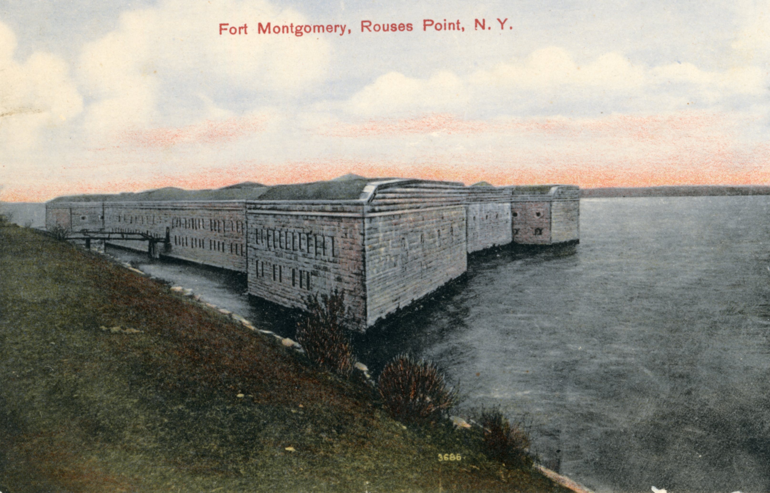
The construction that began in 1844 was new from the ground up and the ground down and the fort was named Fort Montgomery in honor of the American general who lost his life during the attack on Quebec. The new fort would enclose about one acre in area, suitable for a garrison of 800 men. Work on Fort Montgomery went forward slowly until the outbreak of the Civil War, when construction was accelerated to protect against raids down the Richelieu by Confederate sympathizers known to be assembled in Montreal. Under the direction of Captain David White, a resident of Rouses Point and a descendant of Jacques Rouse, the village's first permanent white settler, the north face of the fort was raised quickly, and guns were mounted.
After the Civil War, construction continued until about 1872 with the fort essentially complete and all guns installed. But it was never garrisoned, and the guns were removed early in 1900. A caretaker remained in charge until about 1920 when all supervision by the War Department ceased. Then vandals began their assaults and removed or destroyed much of the interior of the fort.
Some ten years later the fort and the lands of the military reservation about it were sold to the contractor constructing the bridge between Rouses Point and Alburg, VT, who used stone from the fort for the causeway approaching the bridge. Approximately one-half of the outer walls of the fort were destroyed and the remainder left in ruins. Today the remainder of the fort lies on private property, and its remnants can be seen when crossing on the bridge between Vermont and New York.
Editor’s note: Neither fort was ever garrisoned or ever fired a gun in defense of the United States. Jim Millard has since done extensive documentation on the Fort’s history. His books are available at the Clinton County Historical Association’s gift shop.